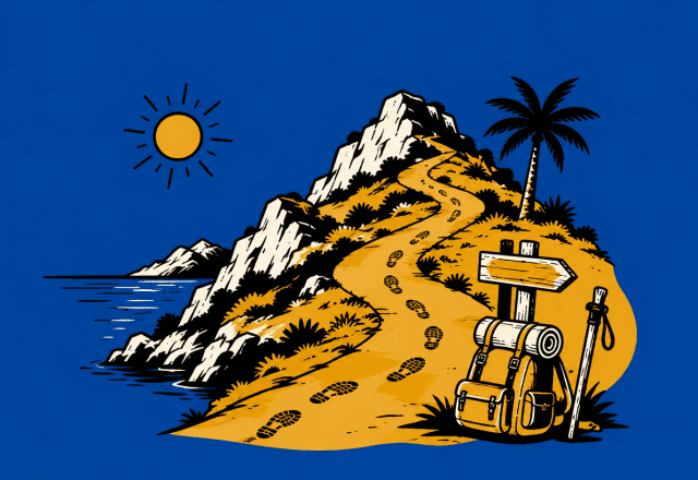
You don’t come to Mallorca in summer to punish yourself up a scree slope at midday. You want blue water, short walks, shady paths, and somewhere good for a cold drink afterwards.
That combination exists all over the island, if you know where to look and how to time it around the 2026 heat.
This guide focuses on genuinely easy hikes and short walks that work in summer: coastal breezes, limited elevation, options to shorten or skip the steep bits, and clear access information that reflects current 2026 parking, transport and regulations.
Why Mallorca Is a Perfect Summer Hiking Destination
Mallorca is small enough that you can sleep in one place and reach coast, countryside, and mountains within an hour. Yet it’s varied enough to give you dune systems, wetlands, holm‑oak forests, and Tramuntana viewpoints without needing big ascents.
For summer 2026, it’s especially attractive if you:
- Prefer short morning or evening walks rather than full‑day treks.
- Don’t want to rent a car thanks to free island‑wide public transport with the Intermodal/Single Card.
- Like to pair a walk with a swim or a meal in a village or beach town.
The famous long‑distance routes (like the GR‑221 and the brand‑new GR‑226 in the east) set the hiking reputation, but many of the most enjoyable routes in July and August are the easy fringe sections and short nature trails.
Essential Summer Hiking Tips for Mallorca 2026
Staying Safe in Summer Heat
Summer 2026 is expected to be hotter than average, with July and August daytime highs commonly hitting 31–34°C and occasional spikes above 40°C. Treat heat management as non‑negotiable.
Best time of day
- Start early: Aim to be walking between 5–9 a.m. That’s when temperatures sit closer to 18–23°C.
- Evening option: Short strolls work well 7–10 p.m. when heat drops and the light is soft.
- Avoid 11 a.m.–6 p.m. on exposed routes. That’s when heat, humidity, and UV combine into the highest risk window.
Hydration and sun
- Drink more than you think: at least 1.5–2 litres per person for even a short summer hike, more if you’re out over 2 hours.
- Use high‑SPF sunscreen, a wide‑brim hat, and sunglasses with UV protection.
- Pick light, breathable, long‑sleeved clothing that covers shoulders and back of neck.
Watch for heat exhaustion: headache, dizziness, nausea, muscle cramps, unusual fatigue. If it appears, stop immediately, move to shade, cool down with water on skin and sip fluids slowly.
What to Pack for Easy Summer Hikes
You don’t need technical alpine gear, but a few smart choices matter.
Essentials for a 1–3 hour walk:
- Lightweight trail shoes or grippy trainers (rocky paths and loose stones are common).
- 2L water per adult in a refillable bottle or bladder.
- Snacks: fruit, nuts, or a simple bocadillo from a bakery.
- Sun protection: SPF 30–50, hat, sunglasses, light cover‑up.
- Small first‑aid kit (plasters, blister pads, pain relief).
- Offline map app with downloaded area (see “Resources” section).
- Cash or card for cafés, bus tickets if you haven’t sorted the Intermodal Card yet.
- Swimwear and quick‑dry towel for coastal routes.
Optional but smart:
- Trekking poles for older walkers on stony descents.
- A light microfibre towel to wet and drape around your neck during hotter spells.
- Compact power bank if you rely heavily on your phone for navigation.
Sustainable & Responsible Hiking Practices
Mallorca’s most popular trails are under pressure in summer. Keeping your impact low isn’t complicated:
- Stay on marked paths. It protects fragile dune systems and prevents erosion in Tramuntana rock and scrub.
- No litter, including organics. Orange peel and nut shells still count; bins are rarely far away on these easy routes.
- Respect fire risk. Avoid any naked flame, don’t smoke on dry trails, and never discard cigarette butts.
- Give wildlife space. Wetlands and holm‑oak forests are important bird and bat habitats; enjoy with binoculars rather than close approach.
- Use refillable bottles and say yes to tap water in restaurants where safe; it reduces plastic on the island.
If local signage restricts access temporarily (for fire risk, nesting birds, or restoration), respect it and pick an alternative route.
Best Easy Summer Hikes in Mallorca
All routes below:
- Are short or easily shortened.
- Avoid technical scrambling.
- Are realistic in summer when done early or late.
- Include 2026 access and parking context.
Distances and times are approximate; use them as planning guides, not race targets.
Alaró to Castle of Alaró Trail – History and Views (Adapted for Summer)
The classic hike from Alaró village up to Castell d’Alaró is about 7 km with a solid climb. In full summer heat it’s borderline for many casual walkers, but you can adapt it.
Why go
- Hilltop ruins with a panoramic view towards the Orient valley and the Serra de Tramuntana ridgeline.
- Strong sense of history: the castle pre‑dates the conquest of Mallorca and is linked with the story of Cabrit and Bassa, medieval knights celebrated locally.
- Mix of rocky paths and old stone terraces.
Summer‑friendly way to do it
- Shorter option: Drive or taxi up the narrow road to Restaurant Es Verger (popular roast lamb spot) and start from there. It cuts out a big chunk of the ascent.
- From Es Verger, you’re looking at roughly 3–4 km return, still with some climb but much more manageable in the early morning.
Difficulty & accessibility
- Rating: Easy‑moderate in cooler months; moderate even with the shortened version in summer.
- Not suitable for wheelchairs or strollers. Surface is rocky and uneven.
- Children used to walking will usually manage the Es Verger variant if you go slowly and start early.
Parking & access 2026
- Limited roadside parking by Es Verger; expect it to fill by late morning in peak season.
- Park as close to the restaurant as possible without blocking access. Respect any yellow lines (no parking) and avoid blocking passing points.
- In Alaró village, you’ll find more white‑line streets (free) and blue‑line paid spaces; check for any resident‑only signage.
Food & culture
- Book ahead or arrive early if you want to eat at Es Verger on the way down.
- Down in Alaró, cafés on the main square are ideal for a late breakfast once you’re back.
Coastal Walk from Ses Salines / Colònia de Sant Jordi to Es Trenc – Beach Lover’s Paradise
If your ideal “hike” involves bare feet in the sand and multiple swim stops, this is the one.
Route basics
- Distance: 4–10 km depending on how far you go (out‑and‑back or point‑to‑point).
- Time: 1.5–3 hours plus swimming.
- Terrain: Firm sand, some boardwalks and paths behind dunes.
You can start from Colònia de Sant Jordi, Ses Covetes, or Sa Ràpita and walk segments of the Es Trenc shoreline. The beach is famous for its turquoise water and long, relatively undeveloped stretch of sand.
Summer practicality
- Coastal breezes help, but there’s very little shade. This is strictly early‑morning or late‑evening walking.
- It’s a clothing‑optional area in parts; be relaxed about occasional nudity.
Difficulty & accessibility
- Rating: Technically easy, almost flat.
- Not great for wheelchairs or standard strollers on the soft sand; some boardwalk sections are fine but don’t always cover the full route.
- Ideal for families who want a walk‑swim‑walk rhythm rather than continuous hiking.
Parking & regulations 2026
- Parking in this area is tightly controlled due to dune protection and summer pressure.
- Look for official car parks near Ses Covetes, Sa Ràpita, and Colònia de Sant Jordi. They may be paid and fill quickly.
- Yellow lines = no parking; blue lines = pay via machine or mobiAPParc app; white lines = free.
- Fines for illegal coastal parking can be substantial, so follow signage carefully.
Food & extras
- Beach bars and cafés in Colònia de Sant Jordi and Sa Ràpita give you easy lunch options.
- Combine with snorkelling: the water is usually calm and clear in sheltered sections.
Puig de Santuiri Natural Park – Family‑Friendly with Wildlife
Just outside Pollença, Puig de Santuiri is a small conical hill wrapped in holm‑oak woods and traditional dry‑stone walls. It’s protected as a Natural Area of Special Interest for its ecology.
Route basics
- Main loop: Around 40 minutes if you circle the base and ascend.
- Elevation gain: About 140 m.
- Terrain: Forest paths, stony sections, some rough rock stairs.
You can wander the lower circular path in cool shade or head up to the top for views over Pollença and towards the Tramuntana range.
Wildlife and flora
- Dense holm‑oak forest and dwarf palms.
- Chances to spot lizards, geckos, rabbits, hedgehogs, and birds of prey; black vultures are sometimes seen circling overhead.
Summer tips
- In the peak of summer, many visitors skip the sun‑exposed summit and enjoy only the shaded circular route in the woods.
- Go early for wildlife activity and cooler air.
Difficulty & accessibility
- Rating: Easy if you only do the lower loop; easy‑moderate with the summit included.
- The path is uneven and rocky; not suitable for standard strollers or wheelchairs.
- Good for children who like to explore and climb a bit.
Parking 2026
- You’ll usually find informal parking spots close to the trail access outside Pollença.
- Pollença town itself has a mix of free and paid parking. Remember that Alcúdia (nearby but separate) now reserves around 2,000 spaces for residents only; if you’re crossing into that municipality, watch for resident‑only signs and avoid those bays.
Food & culture
- Pollença’s main square is packed with cafés and restaurants, ideal for post‑walk refreshments.
- If you’re visiting on a Sunday, the market livens up the whole area.
La Gola Nature Park, Port de Pollença – Wetland Birdwatching Stroll
If you want a flat, very short walk with educational signs and wildlife, La Gola is hard to beat.
Route basics
- Distance: Around 1 km on paths and boardwalks.
- Time: 20–40 minutes at strolling pace.
- Terrain: Flat, accessible, mostly maintained surfaces.
The small wetland sits just behind the seafront of Port de Pollença. It’s designed for easy public access and works well in summer because you can walk it quickly in the cooler ends of the day.
Birdlife
- Waders, herons, and various small birds use the marshes.
- 2026 is part of a decade that’s seen global concern about migratory bird pressures; local wetlands like La Gola are important stopovers and feeding grounds.
Difficulty & accessibility
- Rating: Very easy.
- Suitable for young children, strollers, and many wheelchair users, though check local info for current surface conditions.
- Benches and viewing points make it ideal for older walkers.
Parking & access 2026
- You’re within the urban fabric of Port de Pollença, so parking means a mix of:
- Blue zones (paid via meter or app).
- White zones (free).
- Spaces can be scarce in peak season evenings; consider arriving on foot from accommodation or by bus.
Food & extras
- Do the walk just after sunrise or before dinner, then head to the promenade restaurants for seafood or tapas.
- Combine with a swim on the main beach or a boat trip later in the day.
Ses Fonts Ufanes – Magical Springs and Gentle Woodland
Near Campanet, Ses Fonts Ufanes is a protected natural phenomenon where underground water suddenly bursts to the surface after heavy rain. In high summer the springs may be quiet, but the area remains a pleasant, easy woodland walk.
Route basics
- Distance: 2–3 km depending on small loops and detours.
- Time: 45–60 minutes.
- Terrain: Forest tracks and trails, mostly gentle.
You walk through holm‑oak woods to the spring area and along stream banks. In late spring or after storms you might see the water surging; in a dry summer, you get a tranquil forest stroll.
Difficulty & accessibility
- Rating: Easy.
- Mostly suitable for families; rugged strollers might manage sections depending on recent maintenance.
- Not ideal for wheelchairs due to natural surfaces and occasional roots or stones.
Parking & regulations 2026
- There’s usually a dedicated parking area signposted from the main road near Campanet.
- As always, obey yellow no‑parking lines and any barriers, especially in periods of higher fire risk.
Food & culture
- Combine with a visit to Campanet village or nearby Caves of Campanet.
- Local bars serve traditional Mallorcan snacks that work well as a post‑walk brunch.
New & Trending Easy Hikes to Explore in 2026
No brand‑new short, easy trails were officially documented as opening in 2025–2026, but one major development matters for planning: the Gran Recorrido del Llevant (GR‑226), completed in January 2026.
It’s a 104.82 km long‑distance route along the eastern side of the island, divided into four main sections:
- Cales de Mallorca → Manacor (24.99 km)
- Manacor → Son Carrió (22.99 km)
- Son Carrió → Artà (23.19 km)
- Artà → Cala Mesquida (22.63 km)
Those are not “easy” day walks. But short sections near certain access points can become gentle summer outings.
GR‑226 Taster: Coastal Stretch Near Cala Mesquida / Artà
- Use the GR‑226 signage to walk short segments close to Cala Mesquida or Costa dels Pins, turning back whenever you’ve had enough.
- You get a flavour of the new route: pine forest, cliffs, and golden beaches without committing to a 20+ km stage.
- Stick to early morning, carry plenty of water, and avoid the more exposed mid‑day sections in summer.
Treat GR‑226 as a menu of bite‑size options: use a map app to identify short, low‑elevation fragments near where you’re staying.
How to Get There: Updated Access, Parking & Public Transport Tips for 2026
You can hike most of these routes without a car thanks to Mallorca’s 2026 transport setup.
Public Transport in 2026
TIB (red/yellow inter‑urban buses, trains, metro)
- Free in 2026 if you use the Intermodal/Single Public Transport Card.
- You must validate on boarding and, where relevant, on exit.
EMT Palma (city buses)
- Also free with the card; cash fares sit around €2.
Airport buses (Aerotib A‑lines)
- Lines like A11 and A33 connect the airport year‑round to resorts such as Calvià, Inca, Sa Pobla, Port d’Alcúdia.
Pick up or top up your Intermodal Card at Plaça d’Espanya in Palma, larger towns, or online where available.
Getting to Key Trailheads
Alaró / Castell d’Alaró
- TIB buses from Palma to Alaró (check line numbers and times on TIB).
- From the village, taxi or walk up to Es Verger if you’re doing the shortened castle hike.
Es Trenc / Colònia de Sant Jordi / Ses Covetes
- Seasonal buses head towards Colònia de Sant Jordi and nearby coastal settlements.
- In high season, check TIB for any dedicated beach routes; they reduce pressure on sensitive parking zones.
Pollença & Port de Pollença (Puig de Santuiri & La Gola)
- From Palma, take TIB lines via Inca to Pollença or Port de Pollença (e.g. 301/302/312/314, verify current 2026 routes).
- From Pollença, Puig de Santuiri is within walking distance or a short taxi ride.
- La Gola lies just behind the seafront at Port de Pollença.
Ses Fonts Ufanes (Campanet)
- Bus or train from Palma to Inca; onward bus to Campanet or nearby stop, then walk to the signed entrance.
- Summer frequencies can be limited, especially on Sundays, so cross‑check timetables.
Driving, Parking & 2026 Rules
Key points for drivers:
Color codes island‑wide
- Blue lines: Paid parking. Use street machines or the mobiAPParc app.
- White lines: Free parking.
- Yellow lines: No parking at any time.
Resident‑only zones (new in 2026)
- Alcúdia: About 2,000 spaces reserved for residents with free permits through 2027. Illegal parking can cost €200.
- Capdepera: Residential streets now need municipal permits; only tiny short‑term bays allow 15‑minute stops.
- Pollensa: Considering similar rules; watch local signage.
Low Emission Zones (ZBE)
- Sóller: Hire cars and unregistered vehicles are restricted on about 12 central streets. Park in designated lots outside the zone.
- Palma: Certain historic areas require an ACIRE permit. If you’re just visiting, use public car parks or park & ride.
Palma parking prices (rough guide)
- Open car parks: €1.25–€2.00/hour.
- Underground garages: €1.30–€3.15/hour.
Public transport plus a short taxi often feels easier than hunting for legal parking on busy summer days, especially in Alcúdia, Pollença, Sóller, and beach hotspots.
Combining Hikes with Mallorca’s Summer Cuisine and Local Culture
One of Mallorca’s strengths is how easily a short hike turns into a half‑day of food and slow exploring.
A few simple pairings:
Valley views + roast lamb
- Do the Es Verger to Castell d’Alaró walk at dawn.
- Eat late lunch at Restaurant Es Verger or head back to Alaró for tapas on the square.
Beach walk + seafood
- Walk a section of Es Trenc from Colònia de Sant Jordi or Sa Ràpita.
- Finish with fresh fish or paella at a marina restaurant in Sa Ràpita.
Family picnic + Tramuntana backdrop
- Explore Puig de Santuiri and use the picnic areas at the base.
- Continue into Pollença for ice cream or a leisurely menu del día.
Wetlands + promenade tapas
- Stroll La Gola in the evening.
- Wander back along Port de Pollença’s seafront for tapas and a sunset drink.
Springs + village café
- Visit Ses Fonts Ufanes then head into Campanet for coffee and local pastries.
Look out for:
- Pa amb oli (bread with tomato, oil, and toppings).
- Ensaimada (spiralled pastry).
- Local wines from Binissalem and Pla i Llevant regions.
Frequently Asked Questions
Which easy hikes are best for very hot days?
Stick to short, shaded, or coastal routes:
- La Gola: quick, flat, with chances to duck back into town quickly.
- Puig de Santuiri (lower loop only): mostly under trees.
- Ses Fonts Ufanes: woodland cover and short distance.
- Very early or late segments of Es Trenc if you combine walking with swimming.
Are these routes suitable for older walkers?
Yes, with some choices:
- Older walkers often enjoy La Gola, Ses Fonts Ufanes, and the lower loop at Puig de Santuiri.
- The Es Verger to Castell d’Alaró variant can work for fit older hikers if started early and taken slowly.
- Bring poles for added stability on stony sections.
Can I use a stroller or wheelchair?
Best bets
- La Gola – most friendly to wheelchairs and strollers due to flat paths and boardwalk.
- Parts of the Es Trenc access boardwalks may be manageable with an all‑terrain stroller, though the sand itself is harder work.
Less suitable
- Puig de Santuiri, Ses Fonts Ufanes, and Castell d’Alaró have uneven, rocky paths.
Always check local, current information and be ready to turn around if the terrain becomes awkward.
What if there’s a heatwave or fire warning?
- Check AEMET (Spanish meteorological agency) forecasts the day before.
On red‑flag days with extreme heat or elevated fire risk
- Shorten or cancel hikes.
- Choose wetland or urban‑adjacent walks like La Gola that allow quick retreat.
- Follow any local closures; don’t enter forested areas if authorities advise against it.
Are there any genuinely new “easy” trails for 2026?
No short, officially designated easy routes have been confirmed as newly opened in 2025–2026. The main change is the completion of the GR‑226, which offers new segments to sample on the eastern side of the island for those comfortable planning their own short out‑and‑back strolls along the way.
Useful Resources – Maps, Apps & Guides for Mallorca Hiking
Reliable tools make short hikes even more relaxed.
Navigation & maps
- Komoot or AllTrails: Popular for downloadable GPS tracks, difficulty filters, and offline maps.
- Official GR‑221 / GR‑226 info: For planning safe, short taster sections of long routes.
- Paper hiking maps are available in many bookshops and tourist offices.
Transport & parking
- TIB app / website: Timetables and route planner for island‑wide buses and trains.
- EMT Palma app: City bus routes and live times.
- Moovit: Aggregated public transport info across operators.
- mobiAPParc: Pay for blue‑zone parking where supported.
Weather & alerts
- AEMET: Official weather warnings, heat and fire risk alerts.
- Local town hall or tourism websites: Updates on resident‑only parking, low emission zones, and any temporary trail closures.
Pick one or two of these routes for your first days on the island. Start with La Gola or Es Trenc to get a feel for the heat and your walking pace, then add in Puig de Santuiri or Ses Fonts Ufanes once you’re comfortable.
For a deeper dive into Mallorca’s outdoors or nearby activities, see:

Alison is a travel writer with a passion for solo adventures, photography, and Mediterranean escapes. She enjoys exploring Mallorca’s scenic coastline, charming villages, boutique hotels, and hidden gems, sharing stories that inspire curious travelers to discover the island beyond the obvious. Her work has been featured in outlets including Forbes, CNN, Travel + Leisure, and Yahoo.